LiDAR
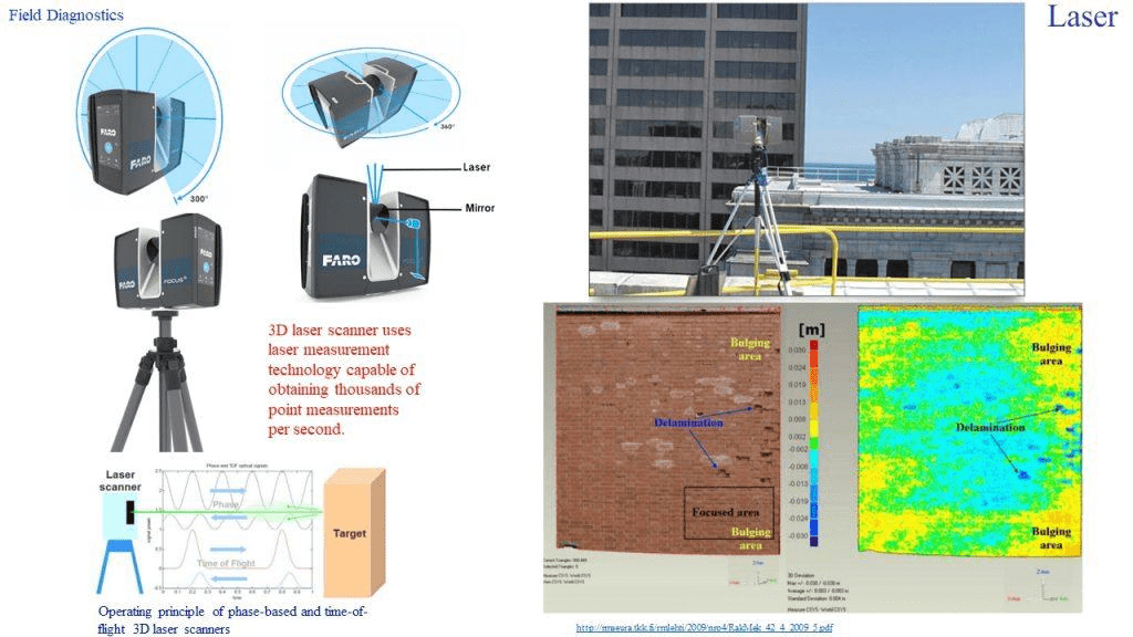
Light Detection and Ranging (LiDAR), or Laser imaging detection and ranging, is a 3-D laser scanning method for determining ranges by targeting an object or a surface with a laser and measuring the time for the reflected light to return to the receiver (Fig. 9.34).
LiDAR technology is used to help track building processes for accuracy, as well as produce digital twins for BIM application and computer simulations.
Usage for aerial inspection by installing LiDAR on drones (UAV LiDAR) provides valuable aerial insight into industrial assets that are usually difficult to inspect, including power lines and civil infrastructure.